Virtually every industry has been affected by computer technology, with civil engineering and land surveying being no exception. Land surveying field measurement procedures have been greatly enhanced from total stations with electronic distance measuring (EDM) and angle measurement, hand held data collection, and global positioning systems (GPS).
The use of computers has also revolutionized civil engineering and land surveying tasks in the office. Over time, the use of computers has evolved from more simple drawing tasks (computer-aided drafting, or CAD) to more sophisticated design tasks (computer-aided drafting and design, or CADD), and we typically use the term “CAD” to mean both computer-aided drafting and design software.
But, more specifically, what is CAD software? CAD is a computer software technology used for the preparation of drafting and design documentation in a two-dimensional (2D) and/or three-dimensional (3D) coordinate systems.
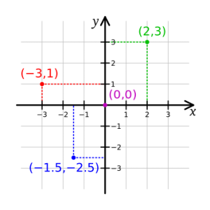
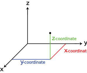
For example, property boundary plats are drawn in 2D space, and topographic survey maps or civil engineering plans with ground surface elevations are drawn in 3D space.
Below are images illustrating basic 2D and 3D coordinate systems.
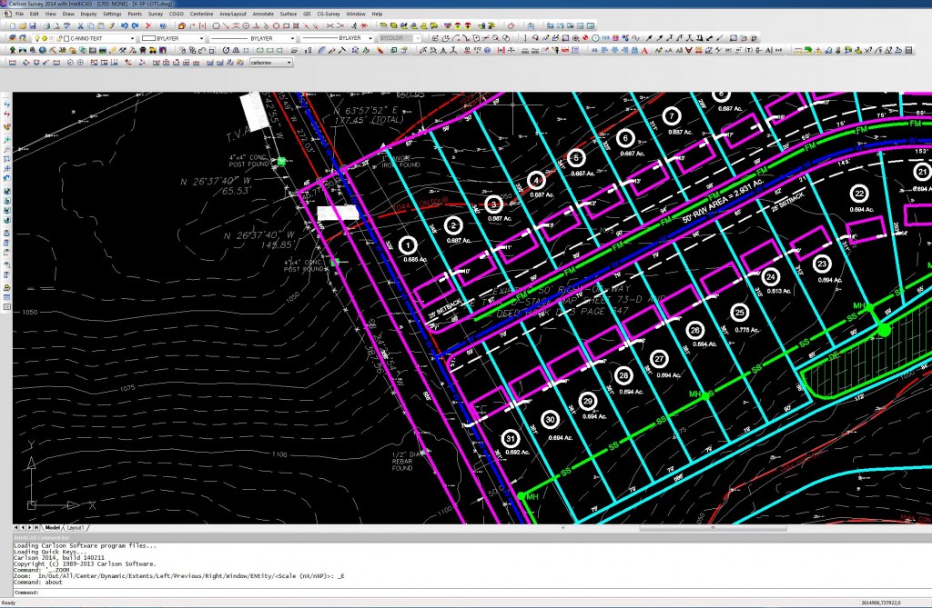
LandTech uses CAD software licensed and distributed by Carlson. Carlson software has modules specifically tailored for civil engineering and land surveying, making our design and drafting process more efficient than using a CAD platform alone. Below is a screen capture of a CAD drawing in Carlson software.
We would love to talk with you about how we can help you with your project. For more information, visit our website http://landtechco.com/contact_us
0 Comments