Oil and Gas Well Location Plats

In recent years, oil and gas production in the United States has expanded, in part due to an innovative technique called “hydraulic fracturing”, commonly called “fracking”.  According to Wikipedia (https://en.wikipedia.org/wiki/Hydraulic_fracturing):

Hydraulic fracturing (also hydrofracturing, hydrofracking, fracking or fraccing) is a well-stimulation technique in which rock is fractured by a pressurized liquid. The process involves the high-pressure injection of ‘fracking fluid’ (primarily water, containing sand and other proppants suspended with the aid of gelling agents) into a wellbore to create cracks in the deep-rock formations through which natural gas, petroleum, and brine will flow more freely. When the hydraulic pressure is removed from the well, small grains of hydraulic fracturing proppants (either sand or aluminium oxide) hold the fractures open.

In Tennessee, the Tennessee Department of Environment & Conservation (TDEC) requires anyone who drills, deepens or reopens oil and gas wells to obtain an Oil and Gas Well Permit. You can find more information on the permitting process at TDEC’s website here: http://www.tennessee.gov/environment/article/permit-other-oil-and-gas-well-permit

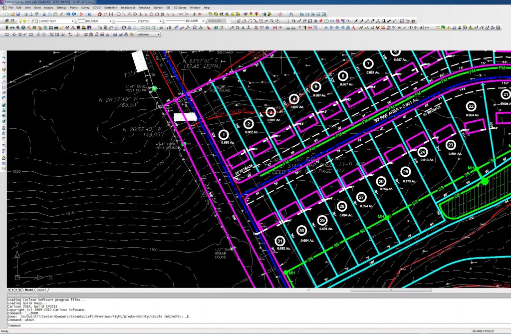
According to TDEC’s instructions, the permit applicant must submit an oil and gas well location plat prepared by a Tennessee registered land surveyor, showing information such as (but not limited to):

  • proposed location of the oil and gas well site;
  • proposed location of all new ingress and egress;
  • location of all diversions, drilling pits, dikes, structures and facilities
  • proposed location of storage tanks and other surface disturbances

A listing of the complete well location plat requirements can be found in the TDEC Oil and Gas Program Rules, Chapter 0400-52-03 Well Location Plats, here: http://www.state.tn.us/sos/rules/0400/0400-52/0400-52-03.20130618.pdf

The civil engineering and land surveying staff at LandTech has experience assisting the oil and gas exploration industry with the preparation of oil and gas well location plats. Contact LandTech if you have any questions about your project.  http://landtechco.com/contact_us

Zoning Appeals

One of the earliest steps in the site design process is a review of the Zoning Ordinance to determine requirements for a particular property based on it’s zoning classification (such as residential, business, commercial, industrial, etc.) The Zoning Ordinance contains information that is relevant to both the land surveyor and civil engineer.

In Knoxville or Knox County, you can find the applicable zoning classification for a particular parcel using the KGIS website: http://www.kgis.org/KGISMaps/Map.htm

Once we’ve identified the zoning classification for a particular property, we will review the local zoning ordinance for a summary of the requirements.

For the City of Knoxville, you can review the Zoning Ordinance here:  https://www.municode.com/library/tn/knoxville/codes/code_of_ordinances?nodeId=APXBZORE

For Knox County, you can review the Zoning Ordinance here: http://archive.knoxmpc.org/zoning/KnoxCounty.pdf

If a proposed site design cannot meet all of the requirements for a particular zoning classification, the owner can apply for a variance. In Knoxville, an applicant submits a site plan to the City’s Plans Review and Inspections Division, and the requested variances are presented to the Board of Zoning Appeals (BZA) for an approval or denial of the requested variance.

You can find more information about the City BZA here: http://knoxvilletn.gov/government/boards_commissions/board_of_zoning_appeals/

You can find more information about the Knox County BZA here: http://www.knoxcounty.org/codes/bza.php

If you have any questions about zoning variance for your project, contact LandTech at http://landtechco.com/contact_us

Post Construction Certifications

An important step for a land development project is confirmation that the final site was constructed in accordance with the design plans. In the City of Knoxville, this step is called a Development Certification.

According to the City’s Land Development Manual, or LDM (website link LDM):

“An approved development certification is one of the items required prior to the release of any bond (also called Performance and Indemnity Agreement) that has been collected by the Stormwater Engineering Division. The development certification is issued by the Stormwater Engineering Division after all construction has been completed in accordance with the design plans and requirements of the Knoxville Stormwater and Street Ordinance.

Appendix A contains a site review checklist for final approval of a constructed site development project and the associated as-built drawing.

Every as-built drawing must be properly certified by the appropriate design professional engineer and the registered land surveyor.”

Therefore, the development certification involves both the civil engineer and the land surveyor.  Land Tech staff includes both professional civil engineers and registered land surveyors that can assist with the development certification process.

Contact us if you have any questions about this process for your project. http://landtechco.com/home


Civil Engineering and Land Surveying Websites

The internet is a technology that has altered our society in many ways, and the civil engineering and land surveying professions are no different. There are many websites we routinely use when working on land development projects. Below are a few examples.

1. Knoxville Code of Ordinances : We use this website to get information on zoning and stormwater regulations for the City of Knoxville.

2. Knoxville-Knox County Metropolitan Planning Commission : This website has information on subdivision regulations, and zoning ordinances for both the City of Knoxville and Knox County.

3. City of Knoxville Engineering Department : This site contains links to various engineering divisions, the BMP Manual, the Land Development Manual, and KGIS mapping for the City of Knoxville.

4. Knox County Engineering Department : This site contains information for the Knox County Engineering Department, such as their stormwater manual and contact information.

5. TDEC Water Pollution Map : This Tennessee Department of Environment & Conservation (TDEC) website provides water quality information for streams and water bodies in the State.

6. USGS Map Locator & Downloader : You can find and download the most current or historic U.S. Geological Survey (USGS) maps, which includes roads, contours, streams, and other relevant mapping information.

7. OPUS : The National Geodetic Survey (NGS) provides an Online Positioning User Service (OPUS) for uploading GPS data and obtaining geodetic (latitude and longitude) or state plane coordinates.

These are just a few of the websites we routinely use to acquire civil engineering and land surveying data needed for our land development projects. If you have any questions about your project, please contact our LandTech staff.

For more information about us, and contact information, visit our website:  http://landtechco.com/home.

Permitting for Construction in a Stormwater Ditch

LandTech was recently contacted by a property owner in Knox County, Tennessee about providing a design for a pipe culvert in his side yard. Approximately 25% of the property is isolated by a stormwater ditch crossing the parcel. The property owner wants to install a pipe culvert crossing for easy access across the swale to the isolated portion of the property.

Sometimes a seemingly simple project involves numerous regulatory issues.

When we visited the site, we noticed a small amount of water flowing in the ditch. This would mean the ditch is technically a “stream”. Construction in a stream requires an Aquatic Resource Alteration Permit, or ARAP, from the Tennessee Department of Environment & Conservation (TDEC). More information about ARAP’s can be found here:

http://www.tn.gov/environment/article/permit-aquatic-resource-alteration-permit

We also discovered this portion of the property is in a FEMA 100-year special flood hazard area. This means the culvert would need to be sized to pass a 100-year flood without impacting the water surface elevation. If you’re interesting in finding the limits of any 100-year special flood hazard area, visit the FEMA Flood Map Service Center website:

http://msc.fema.gov/portal

Needless to say, this project is more complicated than the property owner anticipated, but LandTech can ease your burden by providing the advice and professional land surveying and civil engineering services needed to navigate the complexities of a project like this.

For more information about your project or our services, visit our website  http://landtechco.com/home or give us a call.

Waters of the United States Legislation

The U.S. House of Representatives recently passed legislation to restrict the EPA and U.S. Army Corps of Engineers (USACE) from:

 ….developing, finalizing, adopting, implementing, applying, administering, or enforcing the proposed rule entitled, “Definition of ‘Waters of the United States’ Under the Clean Water Act,” issued on April 21, 2014…..

Of course, the legislation would also need to pass the U.S. Senate to become law, which is doubtful this year.

https://beta.congress.gov/bill/113th-congress/house-bill/5078

This legislation impacts land development professionals, such as civil engineers and land surveyors, because of impacts to stream and wetland permit regulations. New Federal rules could reassign regulatory jurisdiction from State Regulators (such as the Tennessee Department of Environment & Conservation) and Local Regulators (such as the City of Knoxville or Knox County) to Federal Regulators such as the EPA or USACE.

This will definitely be a topic of interest in upcoming sessions of Congress. Stay tuned.

Value of Planning

I was reminded about the value of planning from a recent experience at Neyland Stadium in Knoxville, Tennessee. In the first quarter of the game, I went to the concession stand to buy a hot dog. They had about 20 hot dogs cooking, but had no buns…..and this was in the first quarter of the game!!!

In this instance, proper planning would have required delivery of the same number of buns as hot dogs, but apparently was not done.

The value of planning is no less valuable for civil engineering and land surveying projects. The preparation of good plan drawings is critical for a successful land development project.

For more information on our land surveying and civil engineering services, visit our website http://landtechco.com/home

CAD: A Design Tool for Civil Engineering and Land Surveying

Virtually every industry has been affected by computer technology, with civil engineering and land surveying being no exception. Land surveying field measurement procedures have been greatly enhanced from total stations with electronic distance measuring (EDM) and angle measurement, hand held data collection, and global positioning systems (GPS).

The use of computers has also revolutionized civil engineering and land surveying tasks in the office. Over time, the use of computers has evolved from more simple drawing tasks (computer-aided drafting, or CAD) to more sophisticated design tasks (computer-aided drafting and design, or CADD), and we typically use the term “CAD” to mean both computer-aided drafting and design software.

But, more specifically, what is CAD software? CAD is a computer software technology used for the preparation of drafting and design documentation in a two-dimensional (2D) and/or three-dimensional (3D) coordinate systems.

For example, property boundary plats are drawn in 2D space, and topographic survey maps or civil engineering plans with ground surface elevations are drawn in 3D space.

Below are images illustrating basic 2D and 3D coordinate systems.

354px-Cartesian-coordinate-system_svg
2D Coordinate System
3D Coordinate System


LandTech uses CAD software licensed and distributed by Carlson. Carlson software has modules specifically tailored for civil engineering and land surveying, making our design and drafting process more efficient than using a CAD platform alone. Below is a screen capture of a CAD drawing in Carlson software.

CAD Screen Capture
CAD Screen Capture


We would love to talk with you about how we can help you with your project. For more information, visit our website http://landtechco.com/contact_us

The value of a property survey done by a competent surveyor

As a land surveyor, there is something that I find myself saying to someone almost every day: purchasers of real estate should procure a recent, quality land survey of the property before they buy it. I don’t say this simply to promote my business, in my years of experience I have seen many problems caused by the buyers’ mistaken expectations and sellers’ misrepresentations (usually unintentional), about the property being bought and sold. My advice has two key aspects to it: buyers and sellers both can benefit from 1) getting a survey, and 2) hiring a good surveyor.

The importance of this advice was highlighted in a recent court case from Rhode Island. A prospective buyer of a house had a survey done prior to purchase, and the survey revealed that the developer actually built the house on parkland, not the lot owned by the developer. The Rhode Island Supreme Court ordered the developer to move the house, rather than force a sale of the park property to the developer. The agreement between the park and the original donor of the land required that the land remain part of the park in perpetuity. Lesson: Get a survey before you buy!

Although the story does not give any detail, the developer blamed the fact that house was built in the wrong place on an “innocent surveying mistake”. While this is not enough information to judge the work of another surveyor, it does illustrate that you should do some diligence to make sure you are hiring a competent surveyor, just as you would if you were hiring a doctor, lawyer, or other professional. Lesson: Hire a good surveyor!

If you are interested in reading more about this matter, here is a link to the story, which shows a picture of the house.

Good surveys, make good fences, make good neighbors!

Before and After

“Good fences make good neighbors.”

– from Mending Wall by Robert Frost

Each Spring, everyone’s thoughts turn to outdoor activities. For some, it’s a good time to start planning for that yard fence they have been thinking about for a long time.  I’ve been a licensed land surveyor for 20 years, and given the problems I’ve seen, I cannot stress enough how important it is to know exactly where your property lines are before getting a fence installed. Here is a before-and-after picture showing a recent residential lot survey LandTech did for a client in North Knox County who installed a fence. If you click on the picture above to see it full sized, in the “before” picture on top you can see the line of stakes we set, and in the “after” picture below, you can see the new fence just inside the line of stakes.

If you are thinking of installing a fence, before you do, give us a call for a quote on a survey so you can plan your budget with few surprises.